Looking up
Slope and elevation gained will tell the story of the challenging sections after your ride — in the app.

Created by motoristi.eu
Our new flagship. Everything for your ride.
Our new ultimate motorcycle and offroad device: communicator, group mesh, SOS, and lean and slope history in one rugged unit. MotoComm is our flagship — in development.
This is a concept model of a device in development. Design and specifications may change.
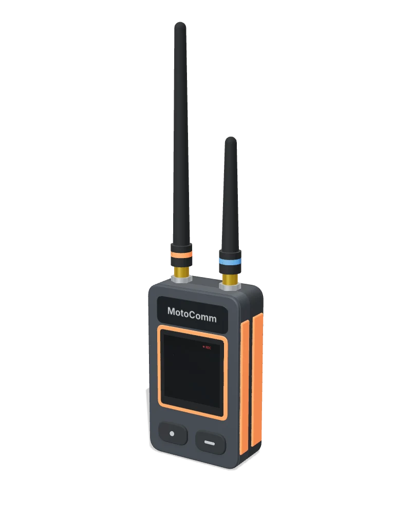
Turn the model, take it apart and see how it all fits into one device.
The model loads when it comes into view.
Drag to rotate · pinch or scroll to zoom · select a part
Climbs, descents and support from the group. We are developing MotoComm for the places where the road becomes a trail.
Slope and elevation gained will tell the story of the challenging sections after your ride — in the app.
Review the steepest descents marked by distance and find them along the shared route.
We are working on tip-over detection and an alert to the group with SOS and location. You will be able to cancel a false alarm.
Explore our SOS conceptYou watch the road. MotoComm will record lean, and the app will help you explore your corners after the ride.
We combine measurements to distinguish corner lean from the forces acting on the bike. Set the zero point on first mounting.
After the ride: left and right peaks, numbered corners and personal records in the app. Only the recording indicator stays on the device.
Talk, regrouping and support share one idea: staying connected to the people you ride with.
Your headset stays paired with your phone. MotoComm and the app will connect the conversation between the group’s devices.
Direction to a friend or chosen waypoint, with location shared with your consent. Useful at junctions and when regrouping.
We are designing SOS with location to the group and cancellation of false alarms. This is support between riders, without a promise of a connection to emergency services.
The device records. After your ride, explore speed, lean, slope and elevation by distance, and your route in 3D in the app.
Move over any chart or use the slider to compare all four readings at the same distance.
Drag to rotate, pinch or scroll to zoom. Keyboard: arrow keys to rotate, + / − to zoom.
Loading the sample ride in 3D…
Illustrative route over simple terrain; no real location. Elevation is exaggerated to show the relief.
We combine a gyro, turn physics and an accelerometer to correct drift. An accelerometer alone reads almost 0° in a turn because the forces align with the bike. Calibrate once on mounting by pressing a button with the bike upright; repeat after moving the mount.
With a direct link, everyone needs to be near the leader. In MotoComm’s mesh network, devices relay the connection between riders. The group can stay connected while neighbouring riders can reach each other by radio, even without mobile coverage.
Illustration of the principle. Real range depends on terrain and will be checked in field tests.
From design concept to prototype: protected edges, seals and separate modules. This is the development direction we still need to test.
Impact-absorbing edges, an IP67 protection target and large buttons. A clean front keeps your attention on the terrain.
Standard AMPS mounting on the back, with a ball mount in the concept model. Explore the back and bottom views and enable the mount in the 3D model.
Battery, antennas and internal modules designed for individual replacement. We are exploring modular enclosure options for easier servicing.
A Bluetooth link to the phone app. Your headset stays connected to your phone while MotoComm links the group by radio.
We are developing crash and fall detection, SOS with location to the group and a way to cancel false alarms.
GNSS positioning for direction to a friend or chosen waypoint, useful on offroad trails too.
We are designing the battery for a full riding day, with convenient USB-C charging. This is a target we still need to verify.
A rugged body targeting IP67 protection, glove-friendly buttons and standard AMPS mounting.
A modular build: battery, antennas and internal modules designed for individual replacement and repair.
For long-range group data and SOS, and clear group voice. Works in every region: choose the region profile and use only what is permitted there.
MotoComm records speed, lean, slope and elevation by distance. In the app: synced charts, a 3D route, ride summaries and personal records.
Here we are: developing the device and its construction.
Checking connectivity, durability and measurements.
Field testing with groups on the road and offroad.
Finalising the design and required validation.
Yes. MotoComm links to the app through Bluetooth, while your headset stays paired with your phone.
Radio links between devices are independent of the mobile network. Range depends on terrain and the links between riders.
We are still developing it. This page shows a concept model and the goals we are working towards. We will share progress here.
In the app: speed, lean, slope and elevation charts by distance, a 3D route, max and average speed, maximum left and right lean, steepest climb and descent, total climb, distance and ride time. The device has a small recording indicator.
Leave your email if you would like news about MotoComm’s development. For now we are only recording your interest; no email is sent.
This is a concept model of a device in development. Design and specifications may change.